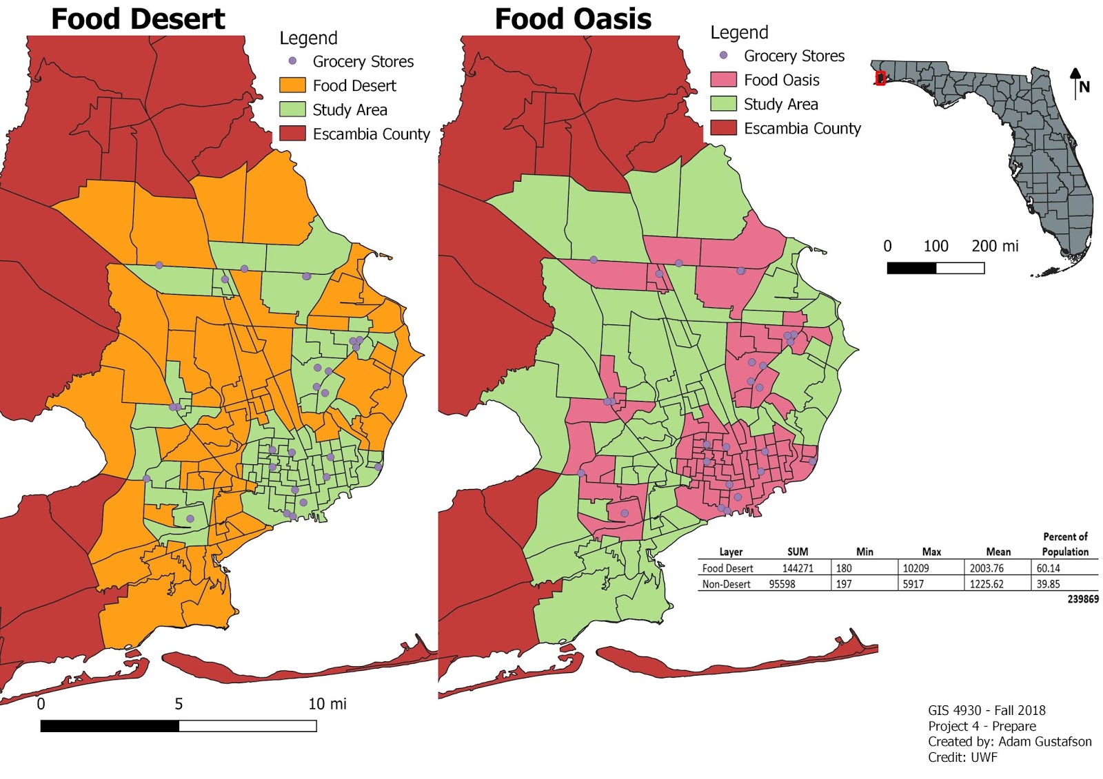
A food desert can be described as an area in a community that has succumbed to health degradation as a result of no nearby nutritional sources.
For the final portion of Project 4 we were tasked with assembling all of our food desert data into one concise power point presentation dedicated to highlighting our food desert area and illustrating how it is effecting the community. I chose my hometown of Navarre, Florida for the study area to my Food Desert Analysis. Navarre is approximately 84.83 square miles in area and 9 grocery stores were identified for this analysis.
GIS programs involved in this analysis included utilizing: ArcMap, Qgis, Leaflet, and Mapbox. Methods involved creating shapefiles for food deserts and grocery stores in Navarre. Shapefiles were uploaded into Mapbox as tilesets and displayed in Leaflet. Arcmap was used to create the study area map. The most challenging technique in this project involved having to create the Navarre food desert shape file. A new Near.csv to reference object id’s within 1 mile and unique to Navarre had to be created along with a new set of centroids.
The data being displayed indicates that grocery stores in Navarre are restricted mainly to highway 98. This restriction creates food deserts the farther north you travel from highway 98. I used my local town and the data does not surprise me. I knew that most grocery stores were located either directly on highway 98 or within at least 1 mile.
Food Desert = 51.67 % of total population
Food Oasis = 48.32 % of total population
From these results one might conclude that Navarre is suffering from a food desert issue but this is not necessarily true. Yes the majority of land cover in Navarre is designated as food desert but the accessibility of highway 98 needs to be taken into account. All of these grocery stores are located less than a mile from highway 98 the main life line of Navarre. The accessibility of these grocery stores allows for Navarre to not be effected as drastically by food desert areas in regards to health and well being.
Navarre is a rapidly growing tourist driven town. There is no way that Navarre is suffering from negative health effects brought upon by inner community food desert intensification. This analysis has revealed that Navarre is majority food desert by total population but the accessibility of grocery stores off sets these food deserts by being located directly on Highway 98, the life line of the Gulf Coast. This analysis has shed light onto areas that can potentially benefit from grocery store construction in Navarre, Florida but like I said before Navarre is not under a food desert threat.