For this weeks section of project 2 we mainly focused on preparing and getting into a group. My group is group 4 and occupies the SE quadrant of the study area.
We were also tasked with preparing two story maps that highlight the steps involved in mountaintop removal mining and the steps involving the finished project such as background info, study site, analysis and discussion.
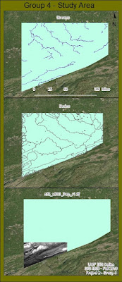
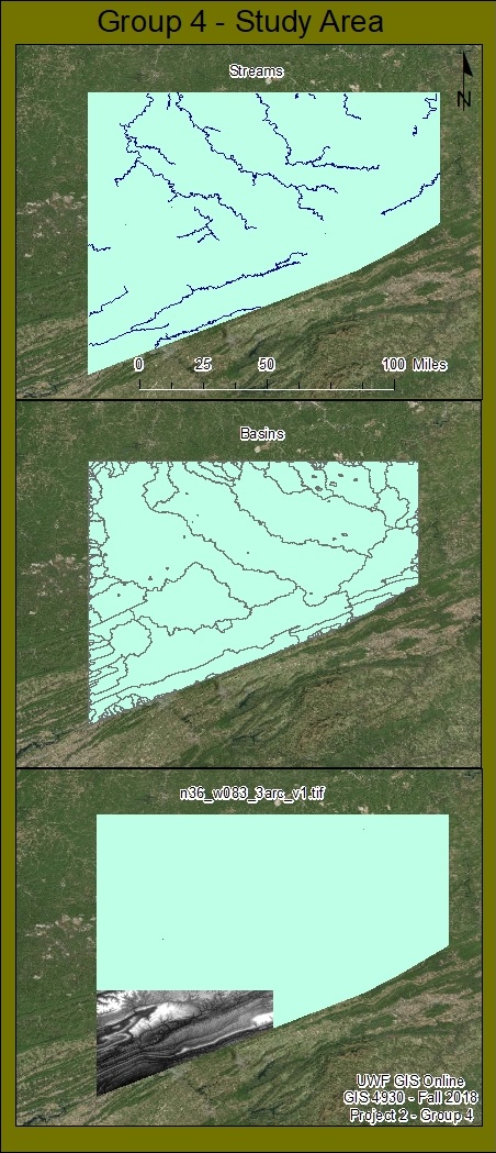
UPDATE: After importing my map files into arcMap and rerunning all tools required to recreate the hydro data files I was successfully able to create the required deliverable for project 2, A single map showing both streams data frame and basins data frame. I've also included a data frame that shows my quadrant (n36_w083_3arc_v1.tif) of group 4's study area for the mountain top removal project.
UPDATE: After importing my map files into arcMap and rerunning all tools required to recreate the hydro data files I was successfully able to create the required deliverable for project 2, A single map showing both streams data frame and basins data frame. I've also included a data frame that shows my quadrant (n36_w083_3arc_v1.tif) of group 4's study area for the mountain top removal project.


No comments:
Post a Comment